Version 80
Date : 2023, February 27th
✨ Product Improvements - Big Steps for Station Based Systems!
Over the last few months, we've seen a significant change in the way that cities we work with are managing shared mobility, especially in urban cores. Instead of allowing purely free-floating parking, with the occasional no parking zone, the majority of a city may be a no parking zone, with allowances only for parking in certain spots. Effectively, a free floating model is being replaced with a station-based model, only with the "stations" often being virtual parking bays.
When we first designed Cityscope, this approach was rare, but it's becoming increasingly common across cities, and we want to make sure it's an easy type of regulation to implement. Because zones and regulations are at the heart of urban mobility management, we have improved the way you can refine them, link them with others and monitor their success. In this version, we deliver two improvements to make regulation development smoother :
- [REGULATIONS]- Buffer Slider / Compliance Buffer
Improvement of the buffer management applicable to a regulation defined in Cityscope : The buffer zone applicable to each rule is now modifiable as much as you want, directly in the user interface, in order to adjust/fine tune the settings for the best detection of each infringements (without having to go through an import, or re-draw the zone). To learn more about how to choose the best buffer for your rules, you can read more in our Knowledge Base.
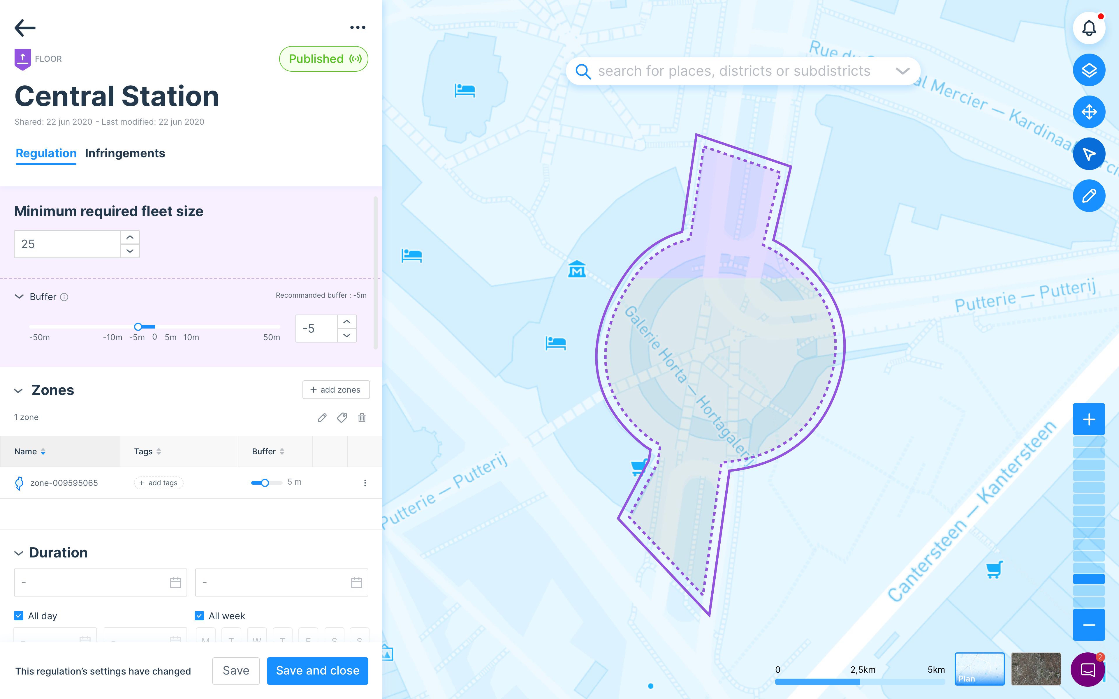
Buffers can be used to control for the GPS inaccuracies inherent in connected vehicles
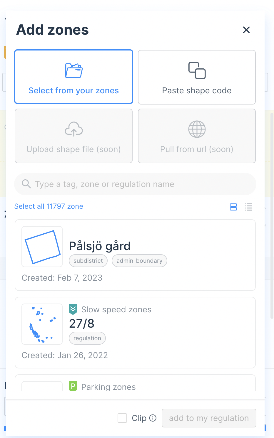
- [REGULATIONS]- Zone explorer - tag experience
Many regulations require the use of existing geofeatures- for example policies that apply to all of your mobility hubs. Previously these features were sometimes difficult to find, or required you to download the features and re-upload them. Now you will have the ability to select zones by name or tag within your existing library. These shapes are available whether they come from your set of custom zones or your regulations. This "Zone Explorer" experience is starting here in Regulations, but look for it to appear in other places in the product such as Report soon!
These two improvements are part of a larger Epic at Vianova to improve the experience for what we informally call the "Swiss Cheese" problem- how to effectively manage lots of small parking zones in a large area where parking is not permitted. We've got two additional features in development right now which will conclude this epic-
- Creating layered policies which can sit on top of one another, which will enable a user to make a change in their parking hub locations without having to change the underpinning no parking areas
- Developing a "mono-metric" report widget, which remains the same even if you modify the location of parking hubs
These are complex features that our team has spent weeks working on, but we hope to reveal the whole experience soon!
✅ Miscellaneous Improvements and bug fixing
- 🧑💻 [ALL] Migration of design component to standardise/unify user experience
- 🗺 [MAP] fix of display of street names
- 📊 [REPORT] fix of display in report name
- ⚙️ [ACTIVITY] Correction on the calculation for the trip % (share of all trips in the period which used this road)
- 🗓 [ACTIVITY] Data display by default is now "yesterday" rather than "past 24 hours", which should speed up the calculation and provide clarity on the metric
As always, our teams are at your disposal to help you get started with these features, so don't hesitate to contact us directly online by chat or by email at [email protected].
Getting started with Vianova -> https://help.vianova.io/