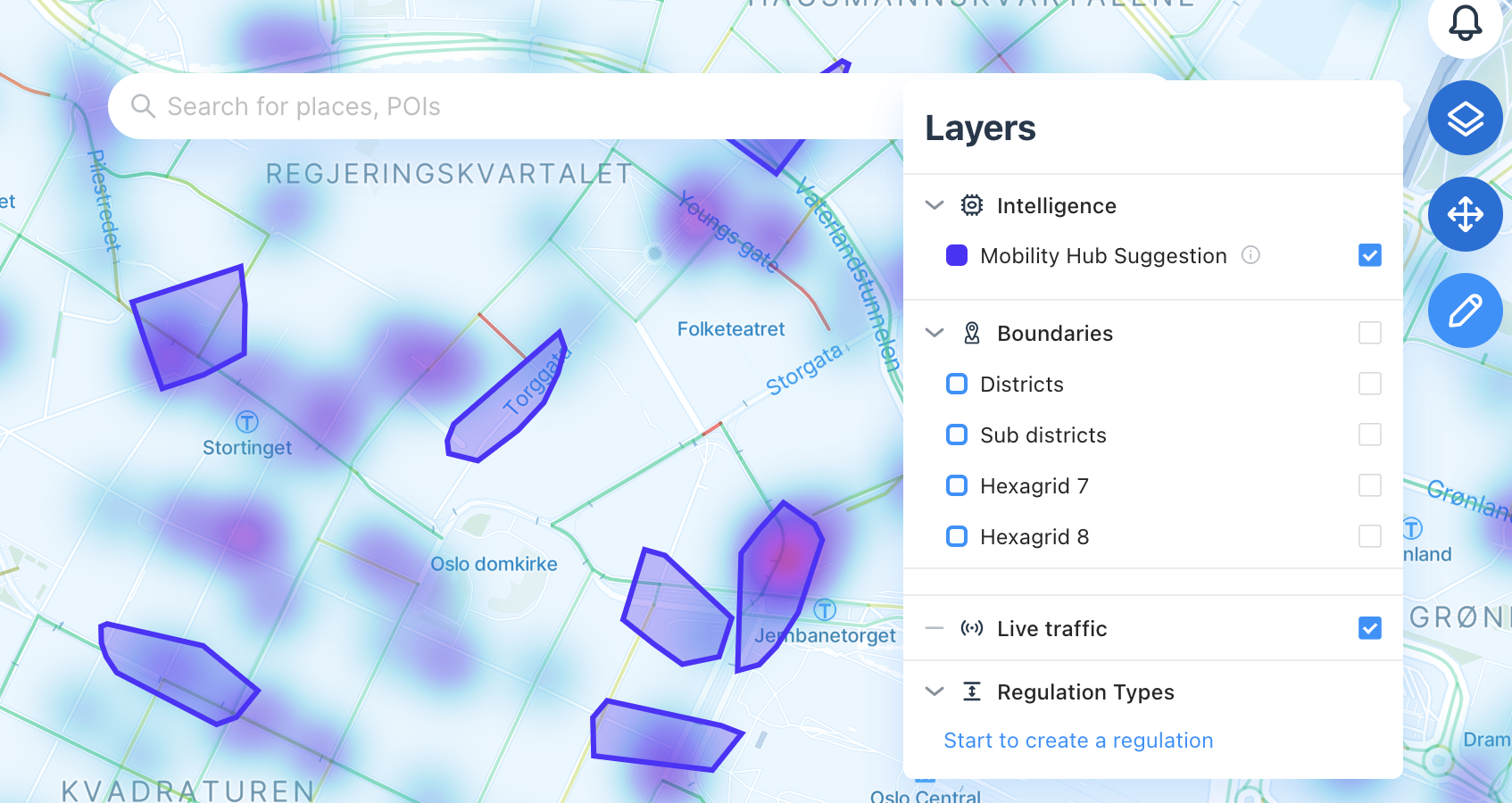
Mobility Hub suggestion
How our intelligent platform will help you design mobility hubs
Our intelligent platform is able to help you find where it makes sense to create a mobility hub by using the data and running some detailed analysis over time to find the best spot.
You will be able to then create the dedicated policy to let providers and users know where they can find devices by following this Designing Mobility Hubs
We also have a comprehensive white paper on Designing Mobility Hubs

How does it work?
Mobility hubs are updated weekly using the following procedure:
For each scope:
- Retrieve the most recent 20,000 trips from the last two weeks.
- Plot the trip-end locations on a map.
- Perform spatio-temporal clustering techniques (DBSCAN) to discover where the "hot-spots" are from the plotted points.
- Filter the candidate hubs to only include a combination of the most-dense (trips-per-square-meter) clusters and the highest-trip-count clusters.
The scan includes hubs of many different sizes- these hubs contain roughly the same number of devices. But when actually constructing hubs, you may need to think about where within an intersection (or even an area of several blocks) to construct the hub in order to maximize it's effectiveness.
How to use it
If the feature is activated for you, you will be able to find it under the "intelligence" sets of layers by clicking on the top right corner.
WarningPlease consider that this suggestion is today not taking into account the physical context. The proposals should be considered along with other locally-specific and domain-specific factors applied by the users of the platform.
This feature helps you identify trends so you can make better decisions.
Updated 3 months ago
